Welcome to the blog of a husband and wife who love going on outdoor adventures. The last few years we have developed a love and appreciation for being outside that we hope to be lifelong and this blog is a way to share our experiences and preserve the memories (Please read the disclaimer at the bottom before trying to replicate any of our adventures!)
Showing posts with label Spring Mountains. Show all posts
Sunday, May 4, 2014
Bonanza - P & K + A & J-dog
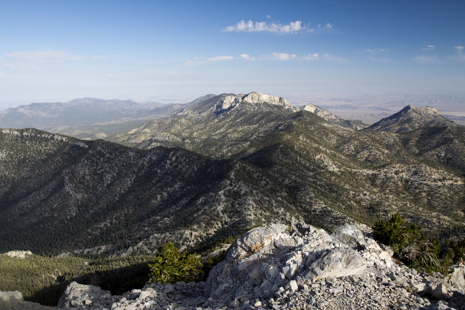
Today we bagged another new peak. We have wanted to hike Bonanza for several years now and just never got the timing right. The peak has some north facing slopes so we wanted to make sure most of the snow was melted, which is was today. The low snow year is going to mean more of Mt. Charleston is accessible earlier than some years.
Driving through the little town (?) or settlement (?) of Cold Creek Canyon was very intriguing. None of us had any idea this place existed. It was a huge step up from our last town on the way to a hike, which was Good Springs. Lots of very nice houses and log cabins. Intriguing! We didn't see any power lines, but did notice most houses had solar panels. More research is to be done on this little town. The Cold Creek Canyon area is also so intriguing because of the number of wild horses that we saw. They were plentiful on the side of the road and some even had new foals trotting along next to them. Dishearteningly we saw why the "wild" horses were located so close to civilization. As were were driving out, we witnessed people feeding the horses and taking their photos and petting them. All the wild horses were clustered in the main drag of the town. They were very calm and did not see alarmed by the traffic or noisy vehicles on the dirt road.
The dirt road to the hike is doable in a passenger vehicle, but it would be a very slow journey. We made quick work of it in our Xterra and found the parking lot for the Bonanza trail very easily. The hike was 10 miles and fairly challenging with just under 3,000 ft of elevation gain. We were partially shaded throughout even with a late start. The temperature was just perfect in the 60's-70's and the wind kept us very cool. The wind at the saddle until the peak was very blustery and made the sweat on our bodies down right chilly. The top of the hike had a great flat area to eat lunch that was fairly protected from the fierce gale blowing on the high point. Unfortunately all three of us could not locate a summit log. We searched and searched and came up empty handed. We may need to put this on the short list to put a log book up there this summer, but I think I will do some searching to see if anyone can point out where it may be located on the web.
Overall, very enjoyable hike. Great company for P and K, as our dear friend Adam and his beloved J-dog came with us. It was a good early season hike and another new peak to add to our list. We also now know the route to hike Willow.
GPX file: https://www.dropbox.com/s/8glm6pe79v7n2iq/BONANZA%20%282%29.gpx
Labels:
Hiking,
Mt. Charleston,
Nevada,
Spring Mountains
Saturday, April 12, 2014
Mt. Potosi
Living in the southern part of Las Vegas, Potosi is a prominent peak. Every single day on my way to work, I stare at it. It has a distinctive shape from our vantage point, and I actually took a photo of it years ago, before I even knew what it was (www.flickr.com/photos/philadendron/3139433323/). It also hold snow in the winter, and it's quite photogenic.
It's also notable because Clark Gable's wife, Carol Lombard, died in a plane crash on the mountain. From what I hear, there is still a ton of wreckage up there from the crash.
There are several routes to the top, but at the time, we wanted a straightforward, drama-free trip, so we chose to drive through Jean to the start of the dirt road that leads to the top.
The beginning of the dirt road is really steep, so steep that on our way back down, we chose to walk backward for a while, as a kind of "downclimb". I think the jury is still out on whether it's as steep as the Frenchman Mountain dirt road.
Obviously, with this being a "road hike", the trip was fairly uneventful, but the top offered some views from a unique vantage point. We were high enough to have unobstructed views of both Red Rock and the Spring Mountains, from the South. There aren't many peaks that afford this. We also met a guy who had approached from the Northwest. He was from Arizona and was visiting relatives, and I could tell by his gear and his athletic build that he probably gets out a lot. Not to mention the fact that he took time out of visiting relatives to climb a trail-less route to a peak.
We were happy to chalk up another peak that had been on our todo list forever. One day, I'd like to attempt a more adventurous route to the top. Specifically, I think there are some options from the North.
Link to the GPX: https://www.dropbox.com/s/f1m19y4hzfsdush/Mt.%20Potosi.gpx
Labels:
Nevada,
Spring Mountains
Location:
Potosi Mountain, Nevada 89161, USA
Sunday, December 8, 2013
Mary Jane Falls - Our 1st Snowshoe!
Since snowboarding season still isn't in full swing, Karen and I had an extra couple days to play with this past weekend. Mt. Charleston made a post on Facebook about a group snowshoe, so we signed up. There were only 10 people on the trip, and at the end, when we were supposed to turn around, the guide said we could borrow the equipment for the rest of the day if we wanted. We decided to take advantage and took the snowshoes up to Mary Jane Falls. Phil had never done this popular hike before, so it was nice to see the falls, especially in the winter when so few people go up.
The snow was plentiful at the lower elevations, but did thin out near the end of the Mary Jane Falls trail. Several people decided to carry on the to the falls with us, but only one other couple made it all the way. They seemed newer to the outdoors and really seemed to enjoy themselves. It was nice to talk with them about snowboarding since they wanted to get into it.
We had a lot of fun and definitely want to do it again in the future. A lot of the snow resorts we visit in Utah actually have snowshoeing and cross country skiing, so maybe one day we will check those out.
The snow was plentiful at the lower elevations, but did thin out near the end of the Mary Jane Falls trail. Several people decided to carry on the to the falls with us, but only one other couple made it all the way. They seemed newer to the outdoors and really seemed to enjoy themselves. It was nice to talk with them about snowboarding since they wanted to get into it.
We had a lot of fun and definitely want to do it again in the future. A lot of the snow resorts we visit in Utah actually have snowshoeing and cross country skiing, so maybe one day we will check those out.
Labels:
Mt. Charleston,
Snowshoeing,
Spring Mountains
Sunday, November 17, 2013
Saturday, October 5, 2013
Charleston Peak- We did it!!
>
After many years of wanting to get to the top of Charleston, we finally did it on the last weekend before the snow fell. It was a challenge, especially for K but we had clear weather and made the most of our opportunity. We have now completed all the highest peaks of Mt. Charleston.
More observations will be written later, but here are the stats and our peak photo for now.
GPX: https://www.dropbox.com/s/opp9onlnzf8d5r0/Charleston%20Peak.gpx
Labels:
Mt. Charleston,
Nevada,
Spring Mountains
Saturday, September 10, 2011
Attempt 2 - Mummy Mountain, Mt. Charleston
Sadly, I will just start out by saying, there is going to be an attempt 3. You can read attemp 1 here. You are reading this from two very sad hikers who were more than up to the Mummy Mountain challenge this time, but mother nature had other plans. We will try to keep this as upbeat as possible, but we are both very frustrated that we are going to have to dedicate yet another weekend to trying to reach the Mummy Mountain Summit. It's not that we don't enjoy the hike, but it's very disappointing because we have lots of other peaks in our area we want to hike, and even more outside of the city. Unfortunately, Karen works 2 weekends of the month. Now that we have upped our difficulty to 10 mile hikes, it is hard for us to do two hikes on the Saturday and Sunday back to back and so we will have spent 6 total weeks waiting to conquer Mummy Mountain. If you knew our conquering personalities, this is a bitter wait as you can see the full Mummy from Las Vegas. Phil looks at it all the time with a sigh.
Anyways, back to describing our adventure. Just as our blog is named, Phil and Karen had quite an adventure on this hike. We started at the same trail head, Trail Canyon, and parked in the lot off of Echo Canyon Road. This time it was much much cooler at the start of the hike. It was only 67 degrees to start, compared to the 80's we started in last time. It was only 52 degrees at our car when we finished. We made very quick work of the first 2 miles to get to the North Loop Trail junction. It took us about an hour and we weren't too winded at all. At the North Loop Junction, we began to notice the rain we had seen to the south was moving more towards our direction. We powered along, past the man-made water trough called Cave Spring, and did almost a horseshoe from the North Trail Junction. We reached our next destination- the scree slope in only about 45 more minutes.
At the scree slope is when the heavier rain had started to fall. About a mile before the scree slope, we passed a bunch of hikers putting on their ponchos. Sadly, we didn't have any ponchos. We had an emergency heat blanket, a signaling mirror, and a hodge podge first aid kit, but no ponchos. At the bottom of the scree slope you are about 3 to 3.3 miles into the hike and we had a decision to make. It's probably about another mile to the summit, but a large climb (We don't know exactly how long to the summit since we are still waiting for our next opportunity). Neither of us wanted to decide to turn back so we continued and tried to climb the scree slope. During the climb, the rain got heavier and heavier and we became very cold, as our poncho-less clothing got soaked. A little over half way up the scree, we decided to go under a thick tree and see if the rain would pass. We whipped out the emergency heat blanket, but it was pretty much useless. The wind blew it around and blew under the thin Mylar type sheet. It was advertised as a two person blanket, but we were so cold, lacked dexterity, and were fighting with the wind, so we couldn't quite make it fully cover us both. We were semi warm where our shoulders touched and that was it.
Under the tree is when we realized we couldn't continue. Not only were we already freezing cold, but we had at least 500 ft to gain in elevation and would only be getting colder. We were also looking straight out over Mt. Charleston and saw nothing but rain and dark clouds. Even the close peak off of the Trail Canyon hike was fogged by rain and barely visible. We saw nothing but having to go down the rest of the hike in pouring rain, so we decided we can not continue up another mile, and then down 4.5-5 miles in soaking rain and so we descended the scree slope. Descending was tricky because all the trees on the ground were wet and slick as ice. At this point, the prepared hikers with the ponchos had caught up to the bottom of the scree and they were going to be turning back as well. They were relieved when we said we were also calling it a day.
Soaking wet and freezing, we decided we may as well run down as far as we could to decrease our time in the storm. It was a brand new experience for both of us, running down a mountain with your pants stuck to your legs, your shoes soaking wet, soggy, and loose, and trying not to trip and break your arm. We also had very heavy packs on since 3L each of water was unnecessary with the colder weather. Being soaking wet and miserable, it didn't cross our minds to dump some of the superfluous water until well over a mile into running. We ran just past the junction to get to the trail canyon trail. At that point, Karen tripped on a rock and narrowly avoided falling (she kept getting pebbles in her shoes.) Phil also insisted that running was colder than walking due to the wind it caused, so we walked the rest of the way down dripping wet.
The only pictures we got were near the time when we decided to start walking down instead of running. It was only a light sprinkle so Phil braved it with his brand new camera and got a few good shots of the storm, and a few of our soaking wet selves. His hands were so cold he could barely get his camera out of the bag because his thumbs and fingers lacked all dexterity. We also got a few shots with an iPhone when we were hiding under the tree on the scree slope. I guess better than last time when we got lost and didn't bother to take any pictures.
As we finished the last mile down, the rain really picked up again and the thunder started. Not that we wanted to get any wetter, but it did make us feel better about abandoning the hike, at least the weather was still crappy and we didn't turn back for nothing. It was the safe thing to not continue, but it wasn't what we wanted to do at all. Finishing the hike, we were pretty down and had to remind ourselves we still completed an almost 7 mile hike, climbed 3,000 feet and made amazing time to the scree. We also started earlier than usual and got to say "Good Morning" to the other hikers without any pause or hesitation, unlike our usual starting time. We both know that our hiking conditioning has increased significantly by the ease that we hiked today and think that next time we will definitely bag Mummy's Tummy.
Anyways, back to describing our adventure. Just as our blog is named, Phil and Karen had quite an adventure on this hike. We started at the same trail head, Trail Canyon, and parked in the lot off of Echo Canyon Road. This time it was much much cooler at the start of the hike. It was only 67 degrees to start, compared to the 80's we started in last time. It was only 52 degrees at our car when we finished. We made very quick work of the first 2 miles to get to the North Loop Trail junction. It took us about an hour and we weren't too winded at all. At the North Loop Junction, we began to notice the rain we had seen to the south was moving more towards our direction. We powered along, past the man-made water trough called Cave Spring, and did almost a horseshoe from the North Trail Junction. We reached our next destination- the scree slope in only about 45 more minutes.
At the scree slope is when the heavier rain had started to fall. About a mile before the scree slope, we passed a bunch of hikers putting on their ponchos. Sadly, we didn't have any ponchos. We had an emergency heat blanket, a signaling mirror, and a hodge podge first aid kit, but no ponchos. At the bottom of the scree slope you are about 3 to 3.3 miles into the hike and we had a decision to make. It's probably about another mile to the summit, but a large climb (We don't know exactly how long to the summit since we are still waiting for our next opportunity). Neither of us wanted to decide to turn back so we continued and tried to climb the scree slope. During the climb, the rain got heavier and heavier and we became very cold, as our poncho-less clothing got soaked. A little over half way up the scree, we decided to go under a thick tree and see if the rain would pass. We whipped out the emergency heat blanket, but it was pretty much useless. The wind blew it around and blew under the thin Mylar type sheet. It was advertised as a two person blanket, but we were so cold, lacked dexterity, and were fighting with the wind, so we couldn't quite make it fully cover us both. We were semi warm where our shoulders touched and that was it.
Under the tree is when we realized we couldn't continue. Not only were we already freezing cold, but we had at least 500 ft to gain in elevation and would only be getting colder. We were also looking straight out over Mt. Charleston and saw nothing but rain and dark clouds. Even the close peak off of the Trail Canyon hike was fogged by rain and barely visible. We saw nothing but having to go down the rest of the hike in pouring rain, so we decided we can not continue up another mile, and then down 4.5-5 miles in soaking rain and so we descended the scree slope. Descending was tricky because all the trees on the ground were wet and slick as ice. At this point, the prepared hikers with the ponchos had caught up to the bottom of the scree and they were going to be turning back as well. They were relieved when we said we were also calling it a day.
Soaking wet and freezing, we decided we may as well run down as far as we could to decrease our time in the storm. It was a brand new experience for both of us, running down a mountain with your pants stuck to your legs, your shoes soaking wet, soggy, and loose, and trying not to trip and break your arm. We also had very heavy packs on since 3L each of water was unnecessary with the colder weather. Being soaking wet and miserable, it didn't cross our minds to dump some of the superfluous water until well over a mile into running. We ran just past the junction to get to the trail canyon trail. At that point, Karen tripped on a rock and narrowly avoided falling (she kept getting pebbles in her shoes.) Phil also insisted that running was colder than walking due to the wind it caused, so we walked the rest of the way down dripping wet.
The only pictures we got were near the time when we decided to start walking down instead of running. It was only a light sprinkle so Phil braved it with his brand new camera and got a few good shots of the storm, and a few of our soaking wet selves. His hands were so cold he could barely get his camera out of the bag because his thumbs and fingers lacked all dexterity. We also got a few shots with an iPhone when we were hiding under the tree on the scree slope. I guess better than last time when we got lost and didn't bother to take any pictures.
As we finished the last mile down, the rain really picked up again and the thunder started. Not that we wanted to get any wetter, but it did make us feel better about abandoning the hike, at least the weather was still crappy and we didn't turn back for nothing. It was the safe thing to not continue, but it wasn't what we wanted to do at all. Finishing the hike, we were pretty down and had to remind ourselves we still completed an almost 7 mile hike, climbed 3,000 feet and made amazing time to the scree. We also started earlier than usual and got to say "Good Morning" to the other hikers without any pause or hesitation, unlike our usual starting time. We both know that our hiking conditioning has increased significantly by the ease that we hiked today and think that next time we will definitely bag Mummy's Tummy.
Link to GPX: https://www.dropbox.com/s/1s2zvnb4fyauzqo/Mummy%20rainout%20GPX.gpx
Labels:
Hiking,
Mt. Charleston,
Nevada,
Spring Mountains
Location:
Mt Charleston, NV, USA
Saturday, September 3, 2011
Lee Peak - Mt. Charleston Phil and Adam
Lee Peak is a hike I've been wanting to do for awhile. The route I decided to take is a shortcut through the Las Vegas Ski and Snowboard Resort. Since I've ridden my board there several times in the winter, I thought it'd be fun to visit in the summer.
You climb over 3000 feet in roughly 1.5-2 miles, so I knew it'd be a tough uphill hike. I also decided it'd be a good opportunity to try out some night/early morning hiking, so I planned to start hiking early in the morning with my buddy to make the summit by sunrise. Then I'd be able to take some amazing photos.
Unfortunately, our "sunrise summit bid" was flawed from the get go. I didn't budget enough time for the drive, I didn't budget enough time for the hike, and I woke up late. We hit the trail at about 5:45, and the sky was already starting to brighten with the rising sun.
The first part of the hike takes you right up the ski run called "The Line" which follows the main chairlift. At the top, you veer left and enter a dirt road just before the ski patrol shack. The road leads to a wash, which you follow up. At this point, if you look to the southwest you should be able to see Lee Peak, the most prominent peak on the ridge. You know you're going the right way when you encounter a small waterfall with water draining into a pipe. From here, you can pretty much see what you need to do; find a way up to the ridge. This is when the easy hiking ends. When we ascended, we simply followed the stream as it went up the mountain, always keeping the ridge in view and moving right (West) whenever possible. There is a lot scrambling up boulders, small waterfalls, and fallen trees as you follow the stream. Later, about 40%-50% to the ridge, it becomes a scramble up loose scree and gravel. The bear crawl will be very useful. The grade here is very steep and we had to rest frequently. Slowly but surely, though, the ridge will come into view and you'll reach the top. At this point, according to my Garmin, we were 1.3 miles into the hike.
Since there aren't a ton of detailed descriptions of this particular route, we had to make some decisions on our own. Specifically, once at the ridge, we were afraid the North Loop trail would descend too far down the other side of the ridge and we'd miss the summit of Lee, so we decided to make our own trail, staying as high on the ridge as possible. This worked, but it made for some very sketchy boulder climbs with some scary exposure. At a couple points we were forced to retreat and find a longer way around the scariest stuff. One particularly nervewracking climb put us at the top of a broad, flat peak with a wind measuring instrument on it. There was no label anywhere on it so I don't know if this peak is named. This was the final peak before Lee.
We reached the 11,300 foot summit of Lee Peak 1 hour 50 minutes into our hike at a distance of 1.93 miles. The 360 degree views from the summit are very nice, and even though the day was very hazy, we could see all the way to Lake Mead. Pahrump was clearly visible to the West. Also, there were nice, closeup views of Charleston Peak and Mummy Mountain in all its glory. We spent about a half hour on the summit eating and taking photos, then we started back down.
We decided to try and take as much of the North Loop as possible back to the ridge, since we didn't want to repeat some of the climbing we had to do on the ridge. Just after starting our descent, however, I slipped when climbing down a rock. My shoulder instantly dislocated (this happens to me a lot) and I fell on some sharp rocks. I had to calmly take my backpack off, raise my dislocated arm up with my good arm, and let the joint fall back into place. It was immediate relief from the pain, but I knew the joint would be tender and delicate the rest of the way down. I also ended up skinning my knees and elbow up pretty bad on that fall.
Following the North Loop back to the ridge worked really well for us. It was much quicker and safer. Once on the ridge, we assessed our line of descent and tried a slightly different one that seemed safer. We sideways-slid our way down the scree until we came to the wash, then picked our way through the fallen trees and sticker plants until we reached the road. From there it was an easy descent through the resort to our car. Total distance was 3.9 miles, elevation gain/loss was 3,219 feet, total time was 4 hours.
So if you're planning to do this hike, here are some quick tips:
You climb over 3000 feet in roughly 1.5-2 miles, so I knew it'd be a tough uphill hike. I also decided it'd be a good opportunity to try out some night/early morning hiking, so I planned to start hiking early in the morning with my buddy to make the summit by sunrise. Then I'd be able to take some amazing photos.
Unfortunately, our "sunrise summit bid" was flawed from the get go. I didn't budget enough time for the drive, I didn't budget enough time for the hike, and I woke up late. We hit the trail at about 5:45, and the sky was already starting to brighten with the rising sun.
The first part of the hike takes you right up the ski run called "The Line" which follows the main chairlift. At the top, you veer left and enter a dirt road just before the ski patrol shack. The road leads to a wash, which you follow up. At this point, if you look to the southwest you should be able to see Lee Peak, the most prominent peak on the ridge. You know you're going the right way when you encounter a small waterfall with water draining into a pipe. From here, you can pretty much see what you need to do; find a way up to the ridge. This is when the easy hiking ends. When we ascended, we simply followed the stream as it went up the mountain, always keeping the ridge in view and moving right (West) whenever possible. There is a lot scrambling up boulders, small waterfalls, and fallen trees as you follow the stream. Later, about 40%-50% to the ridge, it becomes a scramble up loose scree and gravel. The bear crawl will be very useful. The grade here is very steep and we had to rest frequently. Slowly but surely, though, the ridge will come into view and you'll reach the top. At this point, according to my Garmin, we were 1.3 miles into the hike.
Since there aren't a ton of detailed descriptions of this particular route, we had to make some decisions on our own. Specifically, once at the ridge, we were afraid the North Loop trail would descend too far down the other side of the ridge and we'd miss the summit of Lee, so we decided to make our own trail, staying as high on the ridge as possible. This worked, but it made for some very sketchy boulder climbs with some scary exposure. At a couple points we were forced to retreat and find a longer way around the scariest stuff. One particularly nervewracking climb put us at the top of a broad, flat peak with a wind measuring instrument on it. There was no label anywhere on it so I don't know if this peak is named. This was the final peak before Lee.
We reached the 11,300 foot summit of Lee Peak 1 hour 50 minutes into our hike at a distance of 1.93 miles. The 360 degree views from the summit are very nice, and even though the day was very hazy, we could see all the way to Lake Mead. Pahrump was clearly visible to the West. Also, there were nice, closeup views of Charleston Peak and Mummy Mountain in all its glory. We spent about a half hour on the summit eating and taking photos, then we started back down.
We decided to try and take as much of the North Loop as possible back to the ridge, since we didn't want to repeat some of the climbing we had to do on the ridge. Just after starting our descent, however, I slipped when climbing down a rock. My shoulder instantly dislocated (this happens to me a lot) and I fell on some sharp rocks. I had to calmly take my backpack off, raise my dislocated arm up with my good arm, and let the joint fall back into place. It was immediate relief from the pain, but I knew the joint would be tender and delicate the rest of the way down. I also ended up skinning my knees and elbow up pretty bad on that fall.
Following the North Loop back to the ridge worked really well for us. It was much quicker and safer. Once on the ridge, we assessed our line of descent and tried a slightly different one that seemed safer. We sideways-slid our way down the scree until we came to the wash, then picked our way through the fallen trees and sticker plants until we reached the road. From there it was an easy descent through the resort to our car. Total distance was 3.9 miles, elevation gain/loss was 3,219 feet, total time was 4 hours.
So if you're planning to do this hike, here are some quick tips:
- plan on the hike being very strenuous (the Summitpost.org posting for the hike glosses over this a bit)
- plan on there being no defined path for the majority of the hike
- bring some gloves if you don't want your hands to be nicked up by stickers plants, brambles, and sharp rocks
- once you gain the ridge, proceed to the North Loop trail just on the other side. Follow it to Lee Peak. Don't make your own path on the ridge
- especially on the descent, plan on your shoes being full of pebbles and dirt, unless you wear pants
![]() |
| The view over Lee Canyon from Lee Peak. I believe the Sheep mountain range is in the distance. |
![]() |
| Pahrump from Lee Peak |
![]() |
| Charleston Peak from Lee Peak |
![]() |
| The way we came. We picked our way along the ridge over the nearest two humps. |
![]() |
| Victorious |
![]() |
| Lee Canyon |
![]() |
| The wash below the slope up to the ridge is full of debris. |
Partial GPX link as the battery failed: https://www.dropbox.com/s/ny4cs56b5reg4pu/Lee%20Peak%20Adam%20GPX.gpx
Labels:
Hiking,
Mt. Charleston,
Nevada,
Spring Mountains
Saturday, August 27, 2011
First Attempt - Mummy Mountain Tummy Route
We have wanted to conquer Mummy Mountain for quite some time since it's one of the most prominent peaks you can see from the Las Vegas Valley. Since the hike is quite challenging and a long distance, we have slowly built up our hiking skills and decided on this fine weekend we were finally ready for the adventure.
We are not morning hikers and often pass many people coming down from a summit as we are just starting our journey up. Our journey this morning began just before 11am and it was sweltering hot down at the start. We parked at the Trail Canyon Trailhead off of Echo Road. Our beginning ascent was very sweaty and hot, but every now and then we would get a breeze and get the motivation to keep plugging along. Less than a mile in, Karen had to stop and attend to a beginning blister, but she was fully prepared with a package of moleskin. Our feet both got a few wounds by the end.
Since we had wanted to do this hike for quite a while, we had several sources to guide us along the way. Our primary reference was Afoot and Afield: Las Vegas and Southern Nevada: A Comprehensive Hiking Guide by Brian Beffort, a new hiking book Phil got for his birthday. We also had a general hike printout from http://www.birdandhike.com/Hike/Mt_Char/Mummy_E/_Mummy_E.htm , which we figured out on the trail was to get to Mummy Mountain from the raintree hike (we previously hiked Raintree here), so that guide had to be abandoned since we started elsewhere. Finally, we had a topographic map of the Spring Mountains, a hardy and waterproof map Karen picked up from REI. Surprisingly, the topographic map did not have the trail marked to get to Mummy Mountain.
We reached our first turn onto the North Trail headed towards Charleston Peak at about 1.6 miles according to our GPS. This is when our doubts about the GPS began since the book we were using for directions stated we would reach it at 2 miles, but we continued on the North Trail and our next landmark was to be Cave Springs. We passed several hikers coming down and were warned about some red Star Nursery Flags a ways up. The red flags left us puzzled because when you looked to the right, there was nothing but a huge cliff, so we decided this could not possibly be the scree we needed and carried on looking for the Cave Spring (which was in the book and on the topographic map).
We had several mishaps, but not finding Cave Spring had to be one of the main things that led us astray. Along our journey, just past the red flags, we passed a water trough with a pipe. We never in a million years thought this man-made water trough could actually be Cave Spring. Later, after researching more, that water trough was Cave Spring. Silly that it would be on the map as a spring, and even more silly that the book wouldn't point out that Cave Spring was actually a little man-made watering hole.
Not finding Cave Spring really set us back, but we carried on along the North Trail. After quite a while, we passed a hiker coming down who was really nice and she indicated that we had a few more switchbacks and we would reach the scree. She was really nice, but this is another point we were led astray. She also gestered up towards Charleston Peak as where we would find the scree and somewhat led us to believe we had quite a ways to go to get there. So we kept on going and going and going. Karen took a short break to eat some granola not long after we passed this hiker. This is funny, and you will see why later!
After lots and lots of switchbacks and many miles, we came upon a scree!! During all those miles we kept referencing our book. We probably took it out of the backpack no less than 10 times and we kept saying to ourselves, does this look like a stand of dead trees just past a limestone cliff to the east?? That's how the book described where we would find the scree to ascend to the mummy's tummy. Unfortunately for us, there are stands of dead trees and limestone cliffs EVERYWHERE along the North Trail. So each of the 10 times we pulled out the book, we kept wondering which could possibly be the right stand of dead trees!!! We even questioned how many miles it was taking us to get to the magical stand of dead trees, but since our GPS gave us a mismatched mileage earlier, we ignored it.
So finally, we get to a scree. And it is so easy! Easiest scree compared to what we had read about a dreadful scree on this blog. So we had doubts about the effortlessness with which we climbed this baby scree that we'd heard dreadful things about. We climbed it in about 2 minutes (big warning sign) and we just keep on walking along until we come upon a precipitation guage from the USGS and think, hmmm, have we made it??? There was an ammo box with a log in it that a few other people had signed, but it was like less than 20 people in a year. Most of the people that had signed the log were either a part of the USGS inspecting/checking on the precipitation guage or hikers that mentioned heading on to Charleston Peak or Mummy Mountain. BAD sign since we had hiked and hiked and thought we had reached the mummy's tummy.
We carried on along the ridge, did some scrambling and had faint hope we could take this ridge to the tummy. Needless to say, it was a no go. Phil and I did some dangerous scrambling up and down the sharpest rocks trying to salvage our way to our destination. After a while, we finally got to a point where we could see a brown slope that was obvisouly the actuall scree up the our intended destination, it was no joke of a scree. We were already at the top of the scree, but there was a huge hike ahead to get to the top of the tummy. We stat down defeated. We had been hiking over 4 hours and what lied ahead to salvage our mission was just too much. We didn't have enough food or water (we carried 3 liters each already) to hike for 10 hours, we didn't have enough energy to make a 12-13 mile hike and there were ominous storm clouds all over Mt Charleston, but lots above Mummy Mountain.
Running through both our minds was if we should continue on or go back. We reached the same decision silently and decided to eat our PB&Js and then make our journey down. The journey down was full of sliding through loose rocks and mountain debree along an angle to get to the real scree so that we could find our way back without doing the extra miles that we had taken to get to where we were. Our ankles were screaming by the time we got to real trail to descend.
This is probably the saddest part of the whole journey. At the bottom of the real scree, we came across a marker that should have been a dead giveaway to mark our scree for ascencion. A giant dead tree with an M carved into it and an arrow pointing up!!! Why did the book not say this?? Why did the hiker not say this?? And ironiclly, it was literally 200 feet from where Karen had stopped to eat her granola earlier!
Not too much more to the story, except that we hiked down with aching knees, aching ankles, aching backs, and a bit of a defeated feeling since we didn't "bag the peak" (as Phil would joke). The weather was much cooler along our hike up and hike down and the rain that started really felt great. We got to finsh our hike with thunder sounds in the moutain, the smell of rain that reminded us of our dear Allegany, and cool rain drops on our hot skin.
While we didn't get to the mummy's tummy, we did hike 8.5 miles for 6 hours and we did climb 3100 feet, which is by far our longest hiking acomplishment thus far. We also have a thirst to go back and really bag the tummy.
We are not morning hikers and often pass many people coming down from a summit as we are just starting our journey up. Our journey this morning began just before 11am and it was sweltering hot down at the start. We parked at the Trail Canyon Trailhead off of Echo Road. Our beginning ascent was very sweaty and hot, but every now and then we would get a breeze and get the motivation to keep plugging along. Less than a mile in, Karen had to stop and attend to a beginning blister, but she was fully prepared with a package of moleskin. Our feet both got a few wounds by the end.
Since we had wanted to do this hike for quite a while, we had several sources to guide us along the way. Our primary reference was Afoot and Afield: Las Vegas and Southern Nevada: A Comprehensive Hiking Guide by Brian Beffort, a new hiking book Phil got for his birthday. We also had a general hike printout from http://www.birdandhike.com/Hike/Mt_Char/Mummy_E/_Mummy_E.htm , which we figured out on the trail was to get to Mummy Mountain from the raintree hike (we previously hiked Raintree here), so that guide had to be abandoned since we started elsewhere. Finally, we had a topographic map of the Spring Mountains, a hardy and waterproof map Karen picked up from REI. Surprisingly, the topographic map did not have the trail marked to get to Mummy Mountain.
We reached our first turn onto the North Trail headed towards Charleston Peak at about 1.6 miles according to our GPS. This is when our doubts about the GPS began since the book we were using for directions stated we would reach it at 2 miles, but we continued on the North Trail and our next landmark was to be Cave Springs. We passed several hikers coming down and were warned about some red Star Nursery Flags a ways up. The red flags left us puzzled because when you looked to the right, there was nothing but a huge cliff, so we decided this could not possibly be the scree we needed and carried on looking for the Cave Spring (which was in the book and on the topographic map).
We had several mishaps, but not finding Cave Spring had to be one of the main things that led us astray. Along our journey, just past the red flags, we passed a water trough with a pipe. We never in a million years thought this man-made water trough could actually be Cave Spring. Later, after researching more, that water trough was Cave Spring. Silly that it would be on the map as a spring, and even more silly that the book wouldn't point out that Cave Spring was actually a little man-made watering hole.
Not finding Cave Spring really set us back, but we carried on along the North Trail. After quite a while, we passed a hiker coming down who was really nice and she indicated that we had a few more switchbacks and we would reach the scree. She was really nice, but this is another point we were led astray. She also gestered up towards Charleston Peak as where we would find the scree and somewhat led us to believe we had quite a ways to go to get there. So we kept on going and going and going. Karen took a short break to eat some granola not long after we passed this hiker. This is funny, and you will see why later!
After lots and lots of switchbacks and many miles, we came upon a scree!! During all those miles we kept referencing our book. We probably took it out of the backpack no less than 10 times and we kept saying to ourselves, does this look like a stand of dead trees just past a limestone cliff to the east?? That's how the book described where we would find the scree to ascend to the mummy's tummy. Unfortunately for us, there are stands of dead trees and limestone cliffs EVERYWHERE along the North Trail. So each of the 10 times we pulled out the book, we kept wondering which could possibly be the right stand of dead trees!!! We even questioned how many miles it was taking us to get to the magical stand of dead trees, but since our GPS gave us a mismatched mileage earlier, we ignored it.
So finally, we get to a scree. And it is so easy! Easiest scree compared to what we had read about a dreadful scree on this blog. So we had doubts about the effortlessness with which we climbed this baby scree that we'd heard dreadful things about. We climbed it in about 2 minutes (big warning sign) and we just keep on walking along until we come upon a precipitation guage from the USGS and think, hmmm, have we made it??? There was an ammo box with a log in it that a few other people had signed, but it was like less than 20 people in a year. Most of the people that had signed the log were either a part of the USGS inspecting/checking on the precipitation guage or hikers that mentioned heading on to Charleston Peak or Mummy Mountain. BAD sign since we had hiked and hiked and thought we had reached the mummy's tummy.
We carried on along the ridge, did some scrambling and had faint hope we could take this ridge to the tummy. Needless to say, it was a no go. Phil and I did some dangerous scrambling up and down the sharpest rocks trying to salvage our way to our destination. After a while, we finally got to a point where we could see a brown slope that was obvisouly the actuall scree up the our intended destination, it was no joke of a scree. We were already at the top of the scree, but there was a huge hike ahead to get to the top of the tummy. We stat down defeated. We had been hiking over 4 hours and what lied ahead to salvage our mission was just too much. We didn't have enough food or water (we carried 3 liters each already) to hike for 10 hours, we didn't have enough energy to make a 12-13 mile hike and there were ominous storm clouds all over Mt Charleston, but lots above Mummy Mountain.
Running through both our minds was if we should continue on or go back. We reached the same decision silently and decided to eat our PB&Js and then make our journey down. The journey down was full of sliding through loose rocks and mountain debree along an angle to get to the real scree so that we could find our way back without doing the extra miles that we had taken to get to where we were. Our ankles were screaming by the time we got to real trail to descend.
This is probably the saddest part of the whole journey. At the bottom of the real scree, we came across a marker that should have been a dead giveaway to mark our scree for ascencion. A giant dead tree with an M carved into it and an arrow pointing up!!! Why did the book not say this?? Why did the hiker not say this?? And ironiclly, it was literally 200 feet from where Karen had stopped to eat her granola earlier!
Not too much more to the story, except that we hiked down with aching knees, aching ankles, aching backs, and a bit of a defeated feeling since we didn't "bag the peak" (as Phil would joke). The weather was much cooler along our hike up and hike down and the rain that started really felt great. We got to finsh our hike with thunder sounds in the moutain, the smell of rain that reminded us of our dear Allegany, and cool rain drops on our hot skin.
While we didn't get to the mummy's tummy, we did hike 8.5 miles for 6 hours and we did climb 3100 feet, which is by far our longest hiking acomplishment thus far. We also have a thirst to go back and really bag the tummy.
Labels:
Hiking,
Mt. Charleston,
Nevada,
Spring Mountains
Location:
Mt Charleston, NV, USA
Sunday, August 24, 2008
Trail Canyon - Mt. Charleston
This may have been the first time we had ever been on Trail Canyon and little did we know that this beginning would be the start to many hikes in the future once our love of hiking sprouted. We just decided to do a short hike with a friend and Trail Canyon fit the bill that day.
Labels:
Hiking,
Mt. Charleston,
Nevada,
Spring Mountains
Subscribe to:
Posts (Atom)